
Why not make a good public transport map based on the current network?
Dublin’s current public transport network is in dire need for simplification and reorganisation. Initial drafts using the existing network illustrated that a coherent design process cannot simply aim at producing visual graphics for system that has fundamental flaws.
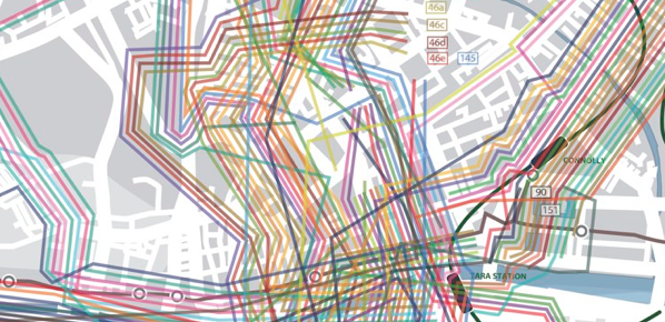
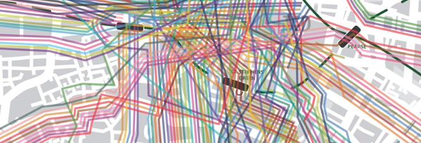


The biggest shortcomings of our present public transport system also turned out to be the obstacles in the production of understandable graphics. Therefore, a visionary network based on upgrades and improvements was created. Existing recommendations of network reviews and reports were used along with existing academic research in sustainable transport solutions for Dublin.
A big mess: All bus routes of the current network hand traced as individual lines into a map of Dublin
(crop city centre)


All content © Aris Venetikidis 2011

Aris Venetikidis
aris.v [at] mac.com
