
Level 3: District maps - like city centre


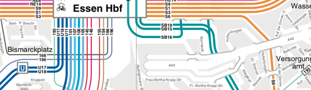
3. The third type of maps many cities include in their series of public transport maps is a district map. At least the important city centre district is featured as a separate district level map in most cities. By showing only a section of the city, the map can hone in on details and information that are not possible on full city maps. The role of local buses is predestined to be displayed on district maps. Even these district level (and city centre) maps need to successfully include transport map elements like simplification, straightening, reduced angles, colour coding and omission of less important information.
Dublin’s city centre is a victim of poor transport planning and features one of the most complicated and complex local bus route networks I have ever encountered. Rather than distributing routes into a grid like structure, everything funnels through the O’Connell Street - Trinity College axis. Therefore every cross city bus user is forced to add the congestion caused by this poor route planning.


All content © Aris Venetikidis 2011

Aris Venetikidis
aris.v [at] mac.com
