
Level 2: Rapid Network only - full city

Level 1: Greater city area - all modes


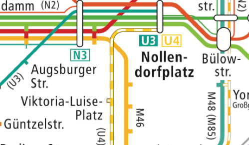
1. Many cities with successful public transport maps feature a series of different maps with very different levels. Naturally, these maps still have to stylistically relate to one another. Often, there is a greater city area map. If it shows all transport modes (bus, tram, train etc.), it usually is not possible to label every stop. At least, there should be a dot though, indicating the presence of stops. The vast amount of information in a map for an entire city area showing all transport modes have to deliberately omit such less important levels of information and/or compromise by making these maps incredibly large. Berlin’s greater area maps with all transport modes is featured in display boxes measuring 2 metres by 1.6 meters(!).
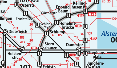
2. Often, cities feature a network of rapid transport, be that underground rail, trams, or rapid bus connections. These rapid connections do not only provide a core network of inter-district travel but can be featured without local buses and therefore be reduced substantially. Frequently, such rapid network maps also omit street level information. The London tube map is an example of such a rapid network map. Dublin however does not have a rapid transport network. Well, it has 2 tram lines and one coastal commuter train, all of which lack interconnections. This can hardly be called a network.


All content © Aris Venetikidis 2011

Aris Venetikidis
aris.v [at] mac.com
