


The benefits of an extensive rapid network in Dublin are threefold:
1. It would offer a rapid transport connection to far away places, away from using local buses for long distance journeys
2. It would greatly simplify the network (rather than having to identify a relevant route in mess of 180 different routes, a selection of around a dozen colour coded lines is much simpler).
3. It would present the opportunity to design a rapid network map for the entire greater Dublin area, which would be reproducible at very small sizes (and is therefore easy to distribute)
Entire greater Dublin Rapid Transit map
The style of such a rapid network map utilises elements of the well established visual language of “metro style maps” (like the Berlin U-Bahn or London Tube Map – nothing to do with the proposed Dublin Metro project). The key to such maps is a suitable geographic (spatial) distortion. Lines are straightened and reduced to horizontal, vertical and diagonal angles. Districts and destinations manifest themselves solely by station names. Bodies of water are the only other information level (streets, street names, parks, landmarks etc. are omitted).
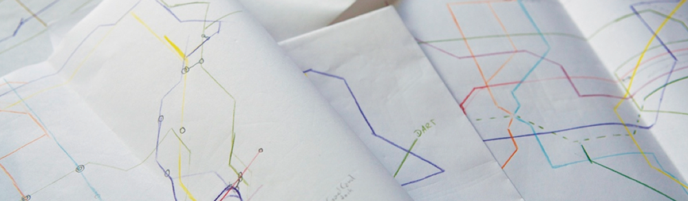
In a long process distortion studies have been drafted by hand and then tested in computer rendered drafts.


All content © Aris Venetikidis 2011

Aris Venetikidis
aris.v [at] mac.com
