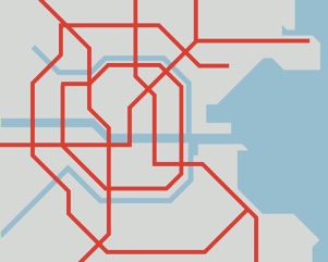

Spatially
distorted
City centre district map
All public transp. modes
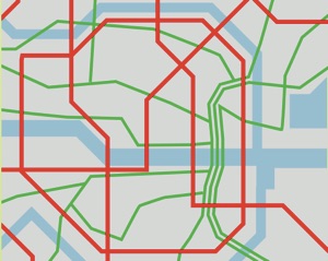
Spatially
distorted
Full greater
Dublin area
Showing rapid
network only


The first two of the above map concepts are more challenging, as suitable custom distortions have to be generated and then filled with simplified transport information. In my MA project I focussed on the design of a distorted greater Dublin area rapid network map and a (slightly less) distorted city centre district map showing all public transport modes.


All content © Aris Venetikidis 2011

Aris Venetikidis
aris.v [at] mac.com
