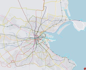

The challenge of showing all transport modes for the entire network is to reduce the sheer amount of information. Secondary stops would not be labeled, but perhaps indicated with dots. Without the benefit of spatial distortion, the city centre in this map would be far too small and complicated. But it could be presented alongside


Spatially
distorted
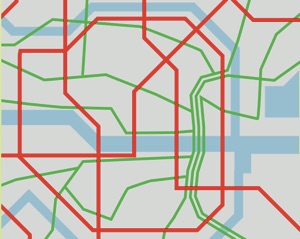
Full greater
Dublin area
Showing rapid
network only
A rapid network map of entire greater Dublin could – if properly spatially distorted – be reduced to very small sizes, yet enable access transport everywhere in Dublin
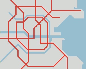
Perhaps the most needed map. There has not been a successful public transport map of the city centre for years (if ever there has been any). A well designed city centre map would have a tremendous impact on people’s journeys within the city centre and open up the entire network to new users.
Spatially
distorted
City centre district map
All public transp. modes
Geographically accurate
Full greater
Dublin area
All public transp. modes
a city centre district map (previous map).


All content © Aris Venetikidis 2011

Aris Venetikidis
aris.v [at] mac.com
